OE-spec
Specifications
| SKU | 740399009962 |
Fitment
WATERPROOF CHARTS · 740399009962
Waterproof Charts 138F Lower St. Johns River Fishing Lake Fishing
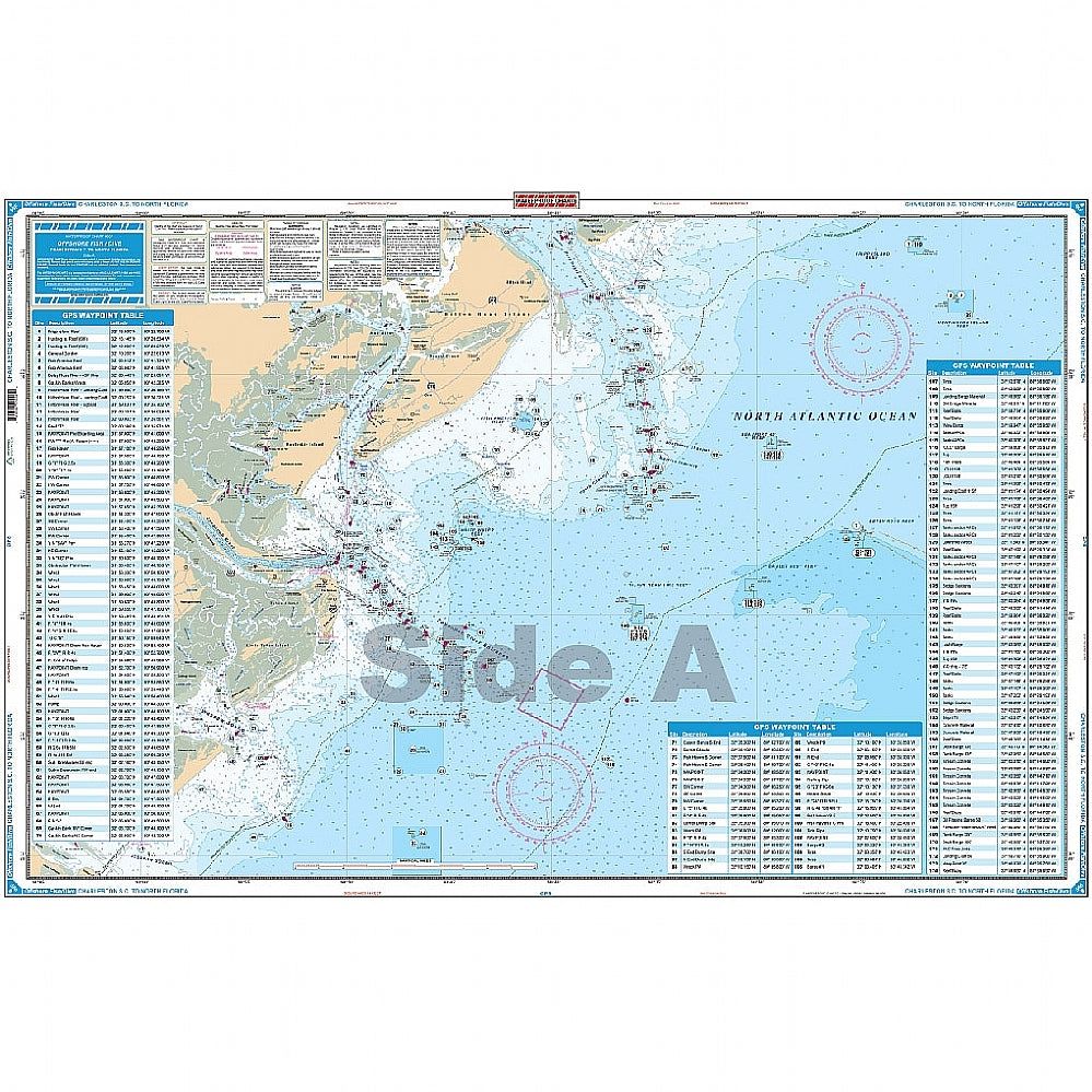
Offshore coverage from the Charleston Light south to 30 miles south of Jacksonville, Florida and offshore approximately 70 miles. Includes the eight "Navy Towers”. Large Print and Large Print Place Names make this chart very easy to read. The reverse side covers the coastal area off of Hilton Head and Savannah out to the Hunting Island Reef (60′ Depth). A total of 390 GPS coordinates are plotted f
No store near you stocks this yet
This part is in our catalog but no nearby shop carries it right now. Check back soon, or search for a similar part in stock near you.