OE-spec
Specifications
| SKU | 1380022 |
Fitment
WATERPROOF CHARTS · 1380022
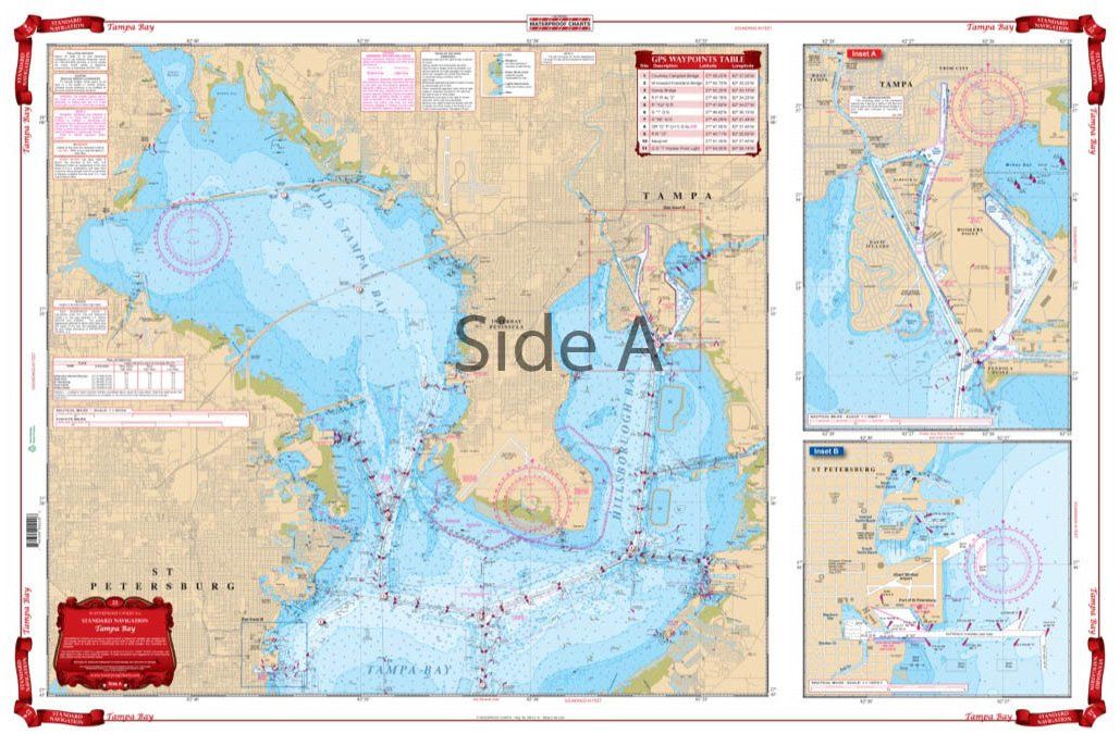
Waterproof Charts 22 Tampa Bay Navigation
Waterproof Charts 22 Tampa Bay Navigation Best detailed coverage for both North and South Tampa Bay and to 10 miles offshore. Includes Manatee River to Interstate 75 Bridge as well as Boca Ciega Bay. Includes Old Tampa Bay. Has blown up detailed insets for St. Petersburg and Davis Island and Hookers Point. This Tampa Bay nautical chart is going to become your best friend while you’re on the water.
No store near you stocks this yet
This part is in our catalog but no nearby shop carries it right now. Check back soon, or search for a similar part in stock near you.