OE-spec
Specifications
| SKU | 1380031 |
Fitment
WATERPROOF CHARTS · 1380031
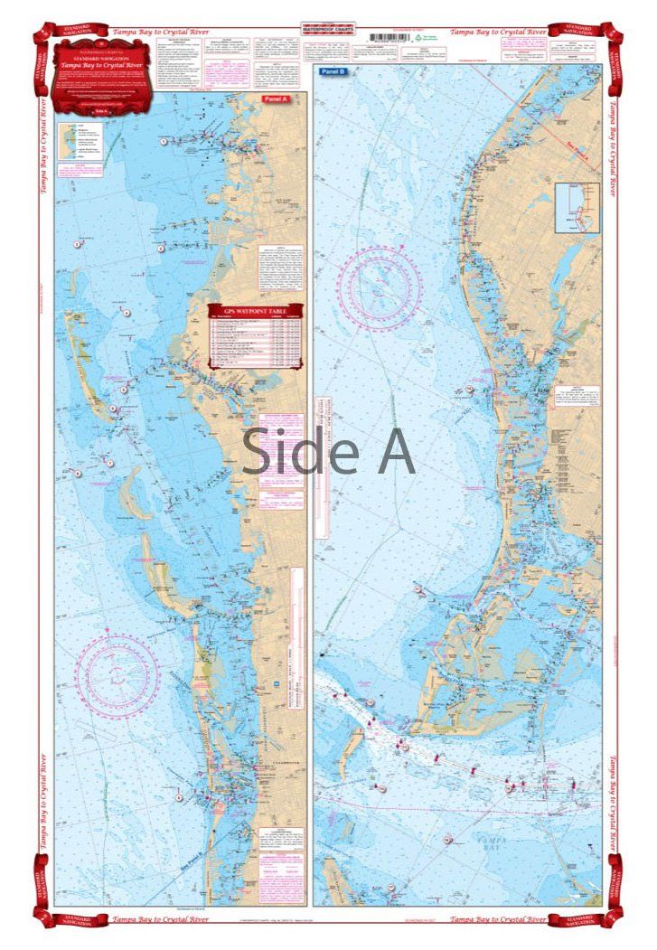
Waterproof Charts 31 Tampa Bay to Crystal River Navigation
Waterproof Charts 31 Tampa Bay to Crystal River Navigation Complete singular and Intracoastal Waterway detail from Anna Maria Island north to Anclote Key and continuing north to north of Crystal River. Covers St. Petersburg Beach, Clearwater, Tarpon Springs, New Port Richey, Hudson, Bayport, Homosassa, and Crystal River. Navigation Chart make areas easy to find and Colored Key makes chart easy to
No store near you stocks this yet
This part is in our catalog but no nearby shop carries it right now. Check back soon, or search for a similar part in stock near you.