OE-spec
Specifications
| SKU | 1380034 |
Fitment
WATERPROOF CHARTS · 1380034
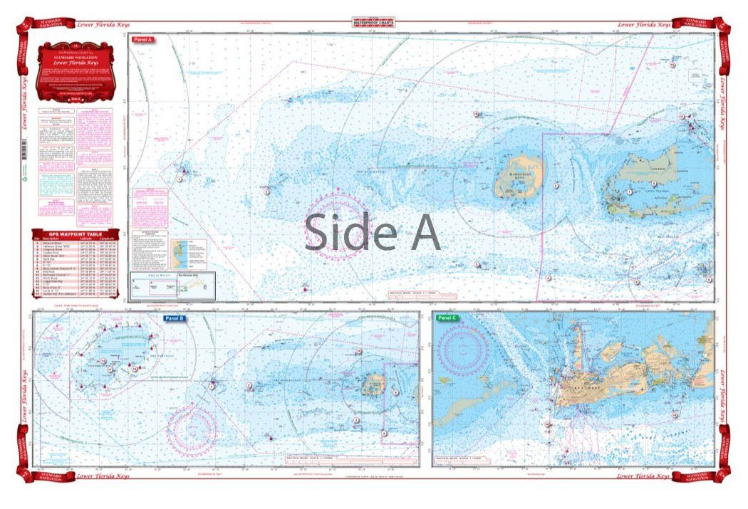
Waterproof Charts 34 Lower Florida Keys Navigation
Waterproof Charts 34 Lower Florida Keys Navigation Coverage from Marathon to Key West on one side, the Marquesas and Rebecca Shoal out to the Dry Tortugas on the reverse side. Detailed blow up for Key West Harbor. Also covers the Big Pine area from the reef to the Content Keys and Turtlecrawl Bank. A total of 18 GPS Waypoints are plotted and indexed. Does not give good detail of the Dry Tortugas (
No store near you stocks this yet
This part is in our catalog but no nearby shop carries it right now. Check back soon, or search for a similar part in stock near you.