OE-spec
Specifications
| SKU | 740399003601 |
Fitment
WATERPROOF CHARTS · 740399003601
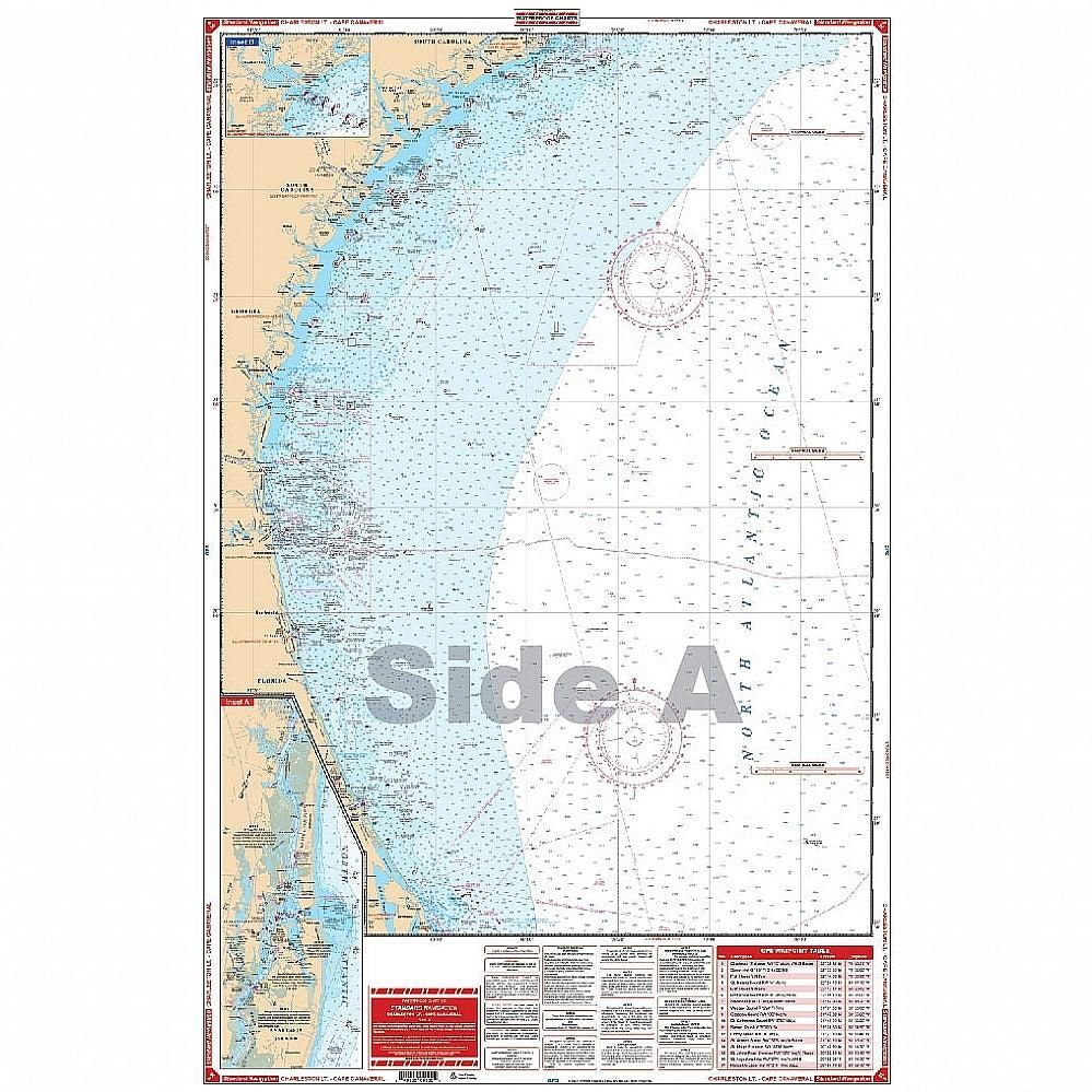
Waterproof Charts 36 Charleston Light to Cape Canaveral Standard
Coverage of the offshore waters from Charleston Light out to a minimum of 87 miles to Cape Canaveral on one side. Coastal coverage from Fernandina Beach south past the St. Johns River entrance to the St. Augustine Inlet on the reverse side. A detail of the St. Augustine area on the coastal side. This is the perfect offshore navigation map for boaters, divers, and fishermen. Coverage of the offshor
No store near you stocks this yet
This part is in our catalog but no nearby shop carries it right now. Check back soon, or search for a similar part in stock near you.