OE-spec
Specifications
| SKU | 1380037 |
Fitment
WATERPROOF CHARTS · 1380037
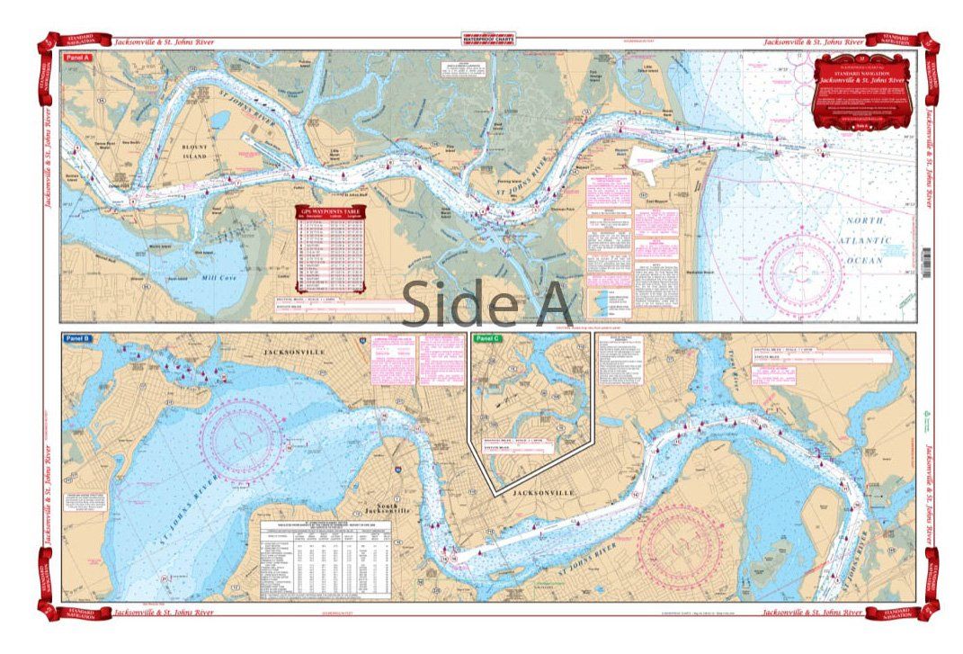
Waterproof Charts 37 Jacksonville and St. Johns River Navigation
Waterproof Charts 37 Jacksonville and St. Johns River Navigation Starting at the Atlantic Ocean, this chart covers up the St. Johns River to city of Jacksonville, continuing upstream through Green Cove Springs, Palatka, covering Murphy and Dunn Creeks and includes all of Crescent Lake. Also covered are the Arlington River and the Ortega River areas in Jacksonville and Doctors Lake. Don’t step on y
No store near you stocks this yet
This part is in our catalog but no nearby shop carries it right now. Check back soon, or search for a similar part in stock near you.