OE-spec
Specifications
| SKU | 1380040 |
Fitment
WATERPROOF CHARTS · 1380040
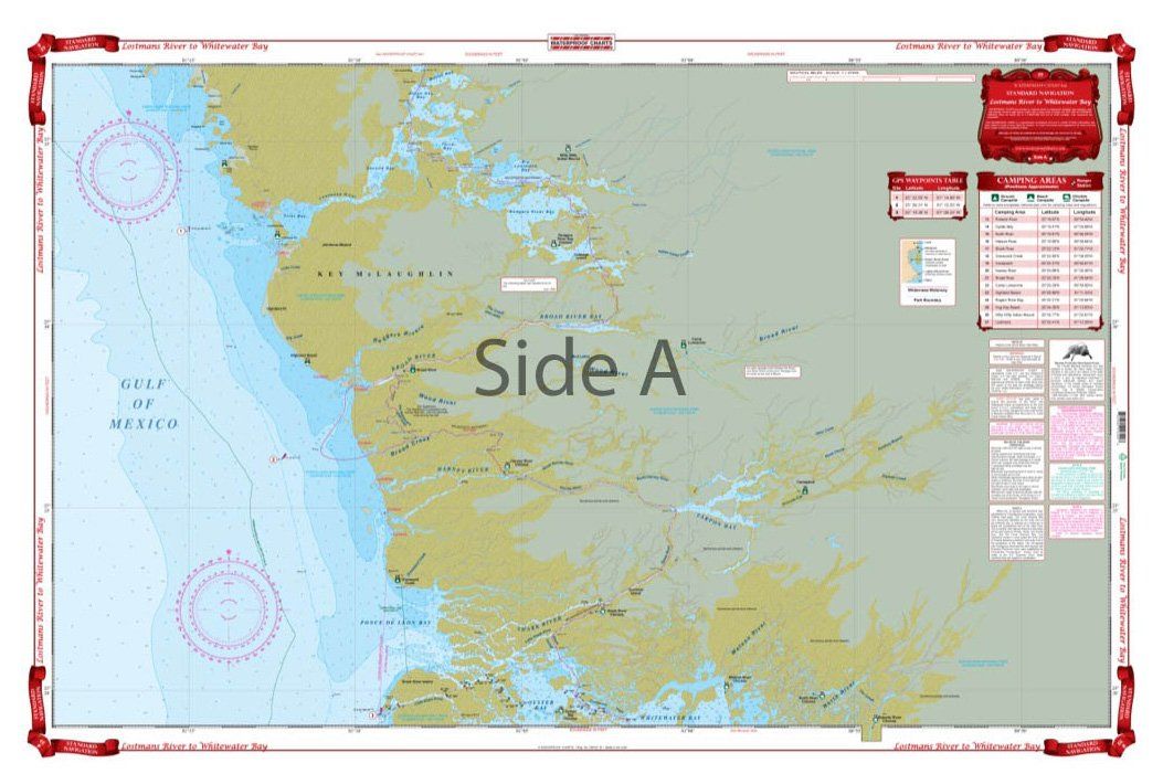
Waterproof Charts 39 Lostmans River to Whitewater Bay Navigation
Waterproof Charts 39 Lostmans River to Whitewater Bay Navigation Detailed Coverage of the southwest Everglades. Coastal and inside coverage from Plover Key south to Shark River on the north side, including Lostmans and Broad Rivers. The south side has detailed coverage of the coast of Cape Sable, and all of Whitewater Bay on the inside. Complete details for the Wilderness Waterway for small boater
No store near you stocks this yet
This part is in our catalog but no nearby shop carries it right now. Check back soon, or search for a similar part in stock near you.